-40%
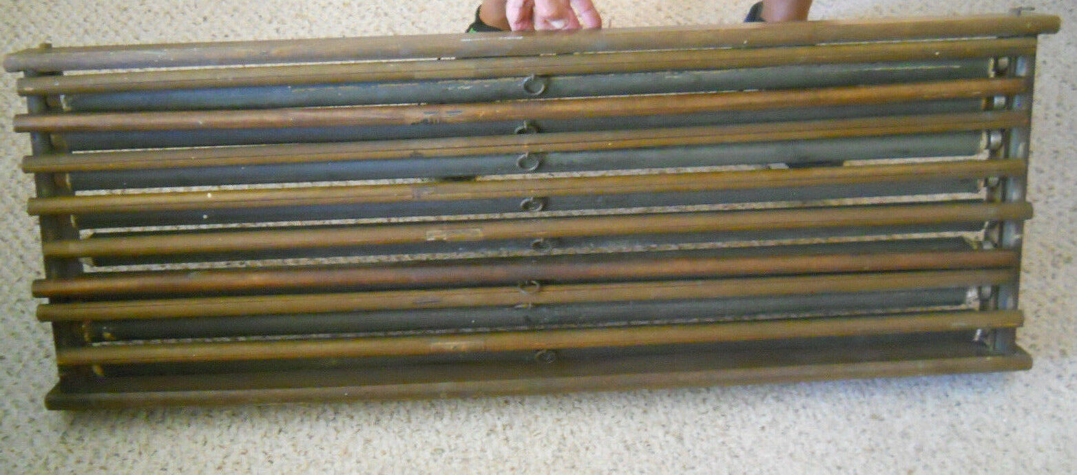
8 Vintage Pull Down AJ Nystrom Maps in Wood Wall Holder-Railroad/Steamers Maps
$ 290.39
- Description
- Size Guide
Description
Vintage wood map holder with 8 AJ Nystrom pull down maps.All maps are sewn to canvas on the bottom edge. Canvas is then attached to a round wood rod with metal ring for pulling map down.
All maps pull down easily. Maps will catch at some point, but will not hold when map is pulled all the way down.
Maps measure approximately 52" x 40" and all have some minor frayed wear to the side edges.
Wood map holder measures approximately 45" long x 16 1/2" tall x 3" thick.
Continue reading for Maps and condition.
Pic #2--North America map. Includes Railroad and Steamer routes.
Map has been torn in several places and has old, yellowed scotch tape.
Pic #3-US and Mexico. Includes Railroad routes. Unusual Countries noticed-British Honduras. Has a line of damage at the Texas/Mexico border.
Pic #4-Europe. Includes Railroad routes. Unusual countries noticed-Soviet Republic, USSR, White Russia.
Has some damage to Egypt.
Pic #5-ASIA & AUSTRALIA. Includes Railroad and Wadies routes. Unusual countries noticed-Siam, French Indochina, No Pakistan, Iran is called Persia, Korea is called Chosen (before 1945). No damage noticed.
Pic #6-AFRICA. Includes Railroad and Wadies routes. Unusual countries noticed-British Somaliland, Italian Somaliland, French Equatorial Africa, French West Africa, Belgium Congo. No damage noticed.
Pic #7-SOUTH AMERICA. Includes Railroad routes. Small hole where the map is sewn to the canvas.
Pic #8-EASTERN HEMISPHERE. Includes Railroad, Steamer, and Cable routes. A little damage under the O in the word Indian Ocean.
Discoloring along the bottom.
Pic #9-WESTERN HEMISPHERE--this map is toast.
Not finding dates on the maps-probably 1930's maps. Each map reads Constructed By W & AK Johnston LTD Edinburgh and Published By AJ Nystrom and Co. Chicago on the top corners--pics 10&11.
Each map has printed on the lower left hand corner Copyright AJ Nystrom & Co.
Rare find.
THANKS FOR LOOKING!
