-40%
Lot of 25 Nautical & Topographic & Info Maps Fenwick Rivers Sandy Hook +++++
$ 47.51
- Description
- Size Guide
Description
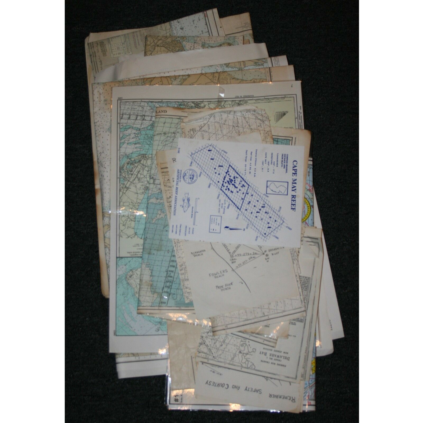
Lot of 21 Nautical & Topographic & Info Maps, Fenwick, Rivers, Sandy Hook And many others as follows:1. 11" X 8.5 Laminated Delaware Bay Locator map, map shows compass readings & approximate Milage.
2. 26.5 " by 22" Paper, Flatbrookville Quadrangle New Jersey-Pennsylvania 7.5 minute Series (Topographic)1954,
3. 38" by 32.5" United States - East Coast, Cape Henlopen to Indian River Inlet, Soundings in feet at mean lower low water scale 1:40,000 North American Datum, World Geodetic System 1984.
4. 37.5" by 25" Waterproof Chart # 56 Cape May to Sandy Hook, NJ, by international Sailing Supply, 2 sided, Original Price .49
5. Three 14" by 8.5 paper , homemade Remember Safety & Courtesy, Delaware coast line maps.
6. & 7 ( Two of these maps) 47.5" by 35" Chesapeake Bay, Eastern Bay and South River, Soundings in feet, at mean low water, #12270
8. & 9 (two of these maps) 47.5" by 36.5" Chesapeake Bay Approaches to Baltimore Harbor,
Soundings in feet at mean lower low water scale 1:40,000
#12278
10. 26.5" 22" paper, Jenkins Quadrangle, Jenkins N.J.
7.5 minute Series (Topographic)
1956
11. 44" by 35" paper, Cape May to Fenwick Island Light, Scale 1:80,000 #12214
12. 26.5" by 22" paper, Atsion Quadrangle, Atsion, N.J. (Topographic) 1953
13. 48" X 32" paper, Delaware River, Smyrna River to Wilmington, Soundings in feet, scale 1:40,000, #12311
14. 57" by 15" Folded 2 sides, Nautical Chart 824-SC Intracoastal Waterway, Sandy Hook to Little Egg Harbor. New Jersey.
15. 42" by 34.5" paper, Little Egg Inlet to Hereford Inlet, New Jersey, scale 1:80,000, #12318
16. 17" by 11" Photo copied Great Egg Harbor Inlet Lake Bay Scull Bay.
17. & .18 ( two of these) 22" by 17" Laminated, Cape May to Fenwick Island, #12214, 1986 & 1993 Charterboat Charts
19. 22" by 21", waterproof, damaged edge, Kencurt Chart #5, 3rd Edition, Delaware Bay #12304
20. 23.5" by 19.5" Laminated, double sided, Delaware Bay, GOS accurate, ASF's factored in. By Home Port Fishing charts inc. 1997.
21. 11" by 8.25, Plastic, Cape May Reef, Artificial Reef Association, 7/92 Loran C Coordinates of Reef Structures.
PLUS some 6 other pieces of maps or very thin paper B/W maps.
FREE USA SHIPPING!
PLEASE
contact me
BEFORE STARTING a return
in SOME cases you may not need to return the item.
If you are interested in this item don't forget to use the best offer feature!
ATTENTION BUYERS:
PLEASE contact me before filling out the buyer survey and leaving feedback. I will do everything I can to remedy the situation. All items will be shipped the same business day of cleared PayPal payment if paid by 7am EST, the next business day if past 7am. Payment is required within 48 hrs.
(24 hrs. if your feedback is less than 100),
unless you contact me prior to purchase. Please read the descriptions carefully as I describe all items as accurately as possible.
